Research
Computational imaging and structured visual perception for optical inspection, agricultural remote sensing, and automated measurement.
Research funding
NSFC Young Scientists Fund (Category C) · Principal Investigator
Imaging Degradation Mechanisms and Visual Perception Enhancement for Early-Stage Weed Identification in Paddy Fields
水稻田苗期杂草识别成像退化机理与视觉感知增强研究
Project 32602720 · 2027–2029 · Awarded, starts in 2027.
Current research
15. Multi-focus defect perception in optical components
Ongoing research
Industry context · Sunny Optical 舜宇光学
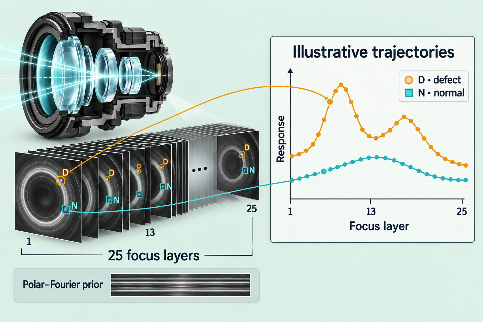
A 25-layer focus stack captures how the same lens region changes with focus. Cross-layer analysis compares response strength and trajectory shape against normal optical-structure evolution, aiming to distinguish defect-related deviations from persistent background patterns.
Polar–Fourier modeling establishes an interpretable reference for normal optical structure. The ongoing extension across focus aims to resolve ambiguities in single-layer inspection, distinguishing defect-related deviations from persistent background patterns and supporting reliable anomaly localization under limited annotation.
14. Multimodal optical localization with Florence-2
Prototype · ongoing evaluation
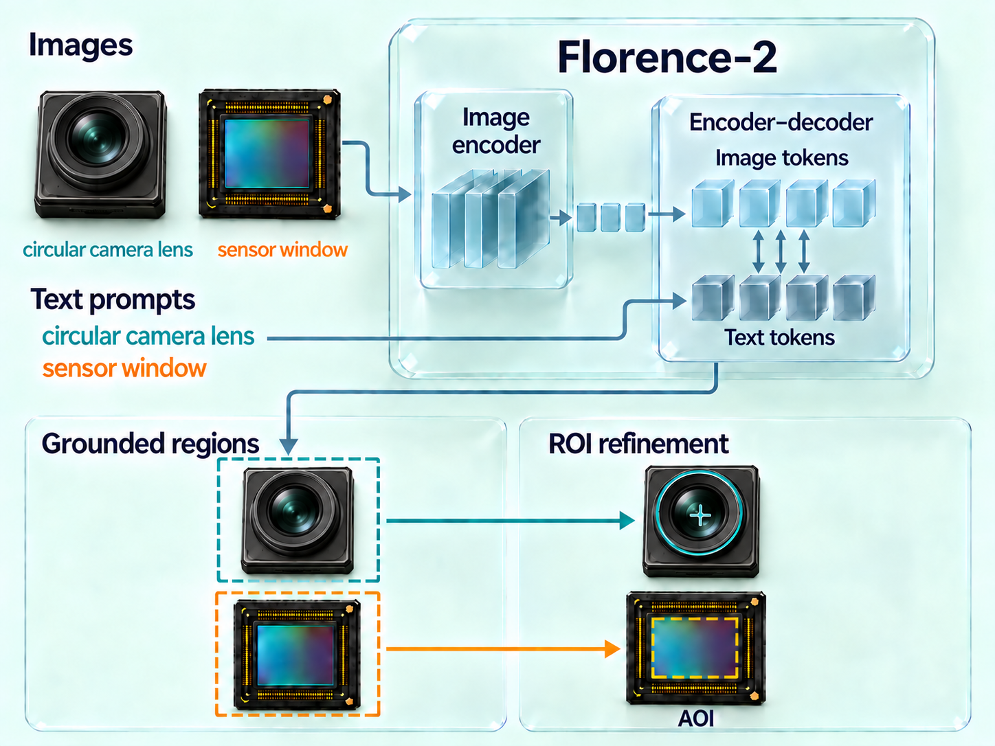
Image features and language tokens jointly enter Florence-2’s multimodal encoder–decoder, converting target descriptions into candidate image regions. This connects semantic prompts with spatial detections for lenses and sensors.
Geometric constraints refine semantic candidates into valid inspection regions; sensor localization uses an outer crop and a second inner-region prompt before mapping back to the original image. This links target recognition to physical component boundaries, aiming to reduce background interference and the reliance on component-specific localization rules.
Previous research
13. Grade2Seg · weakly supervised weed segmentation from severity grades
Research project · revision recorded in 2025
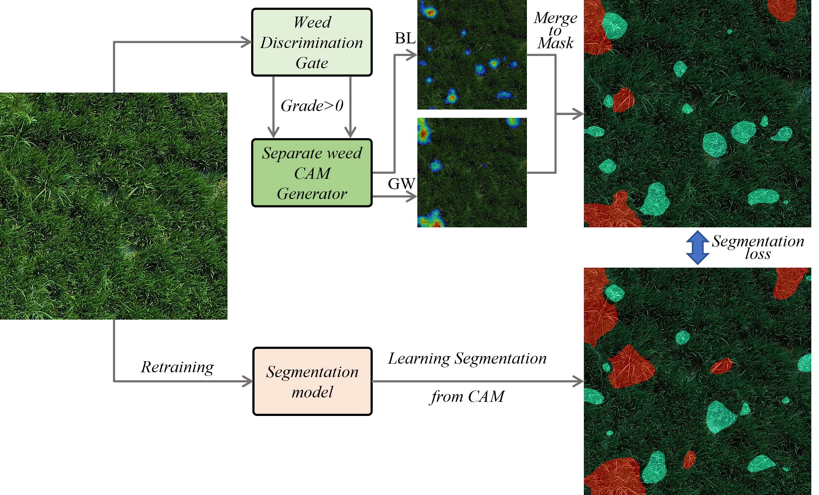
Image-level weed severity grades provide supervision for spatial segmentation. A Sqrt-Error-Weighted ordinal objective learns severity-dependent responses; class activation maps are converted into pseudo-masks for segmentation training.
The workflow produces broadleaf and grass-weed masks from grade annotations, reducing reliance on manually drawn pixel labels. Generalization across field conditions remains an evaluation focus.
12. CropSR / EVADM
Published · ISPRS JPRS 2024
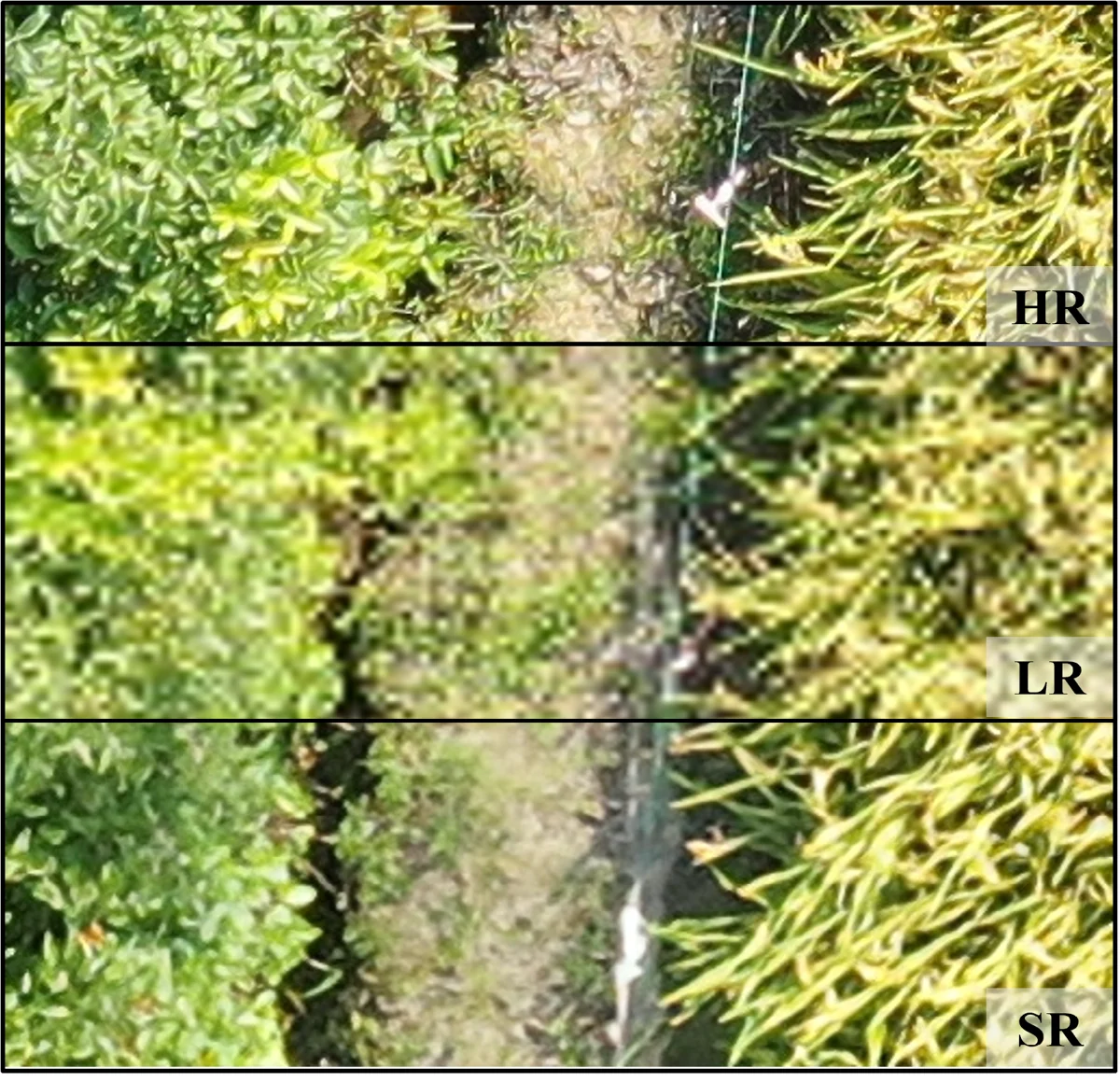
Image variance decreases with increasing flight altitude, providing a scale-sensitive cue for aerial-image restoration. Variance-Average-Spatial Attention (VASA) incorporates this cue into the iterative reconstruction of the EVADM diffusion model.
On the published real-image benchmarks, SRFI improved by 27% at ×2 and 6% at ×4 relative to the baselines. Cross-dataset and downstream evaluations support restoration of fine crop structure for agricultural perception.
11. UAV mapping of lake algal blooms
Research project · 2023
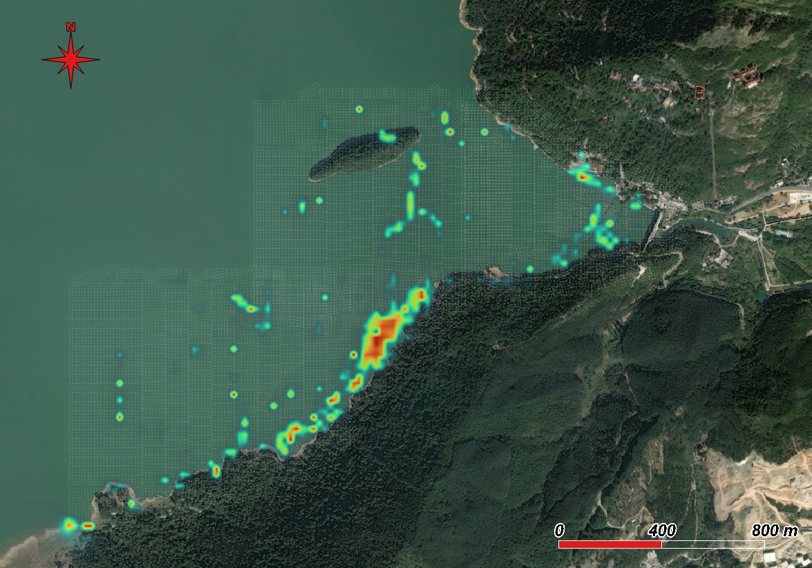
Cascaded waterbody and algal-bloom segmentation separates affected water regions from shoreline and terrestrial backgrounds. Direct geo-location maps image detections into geographic coordinates.
The output is a spatial distribution map of algal-bloom regions, supporting rapid lake surveys and targeted follow-up inspection.
10. PaddySeg · rice-field segmentation and phenology recognition
Published · Drones 2023
Ghost Bilateral Network (GBiNet) combines efficient ghost-convolution features with bilateral segmentation to identify rice regions and four phenological stages in UAV images.
GBiNet_r2 achieved 91.50% test mIoU on PaddySeg, compared with 90.95% for BiSeNetV2, with lower computational cost. The resulting trait masks support field-scale phenology mapping.
9. Direct geo-location & incremental sparse sampling
Published · Drones 2023 · companion method to PaddySeg
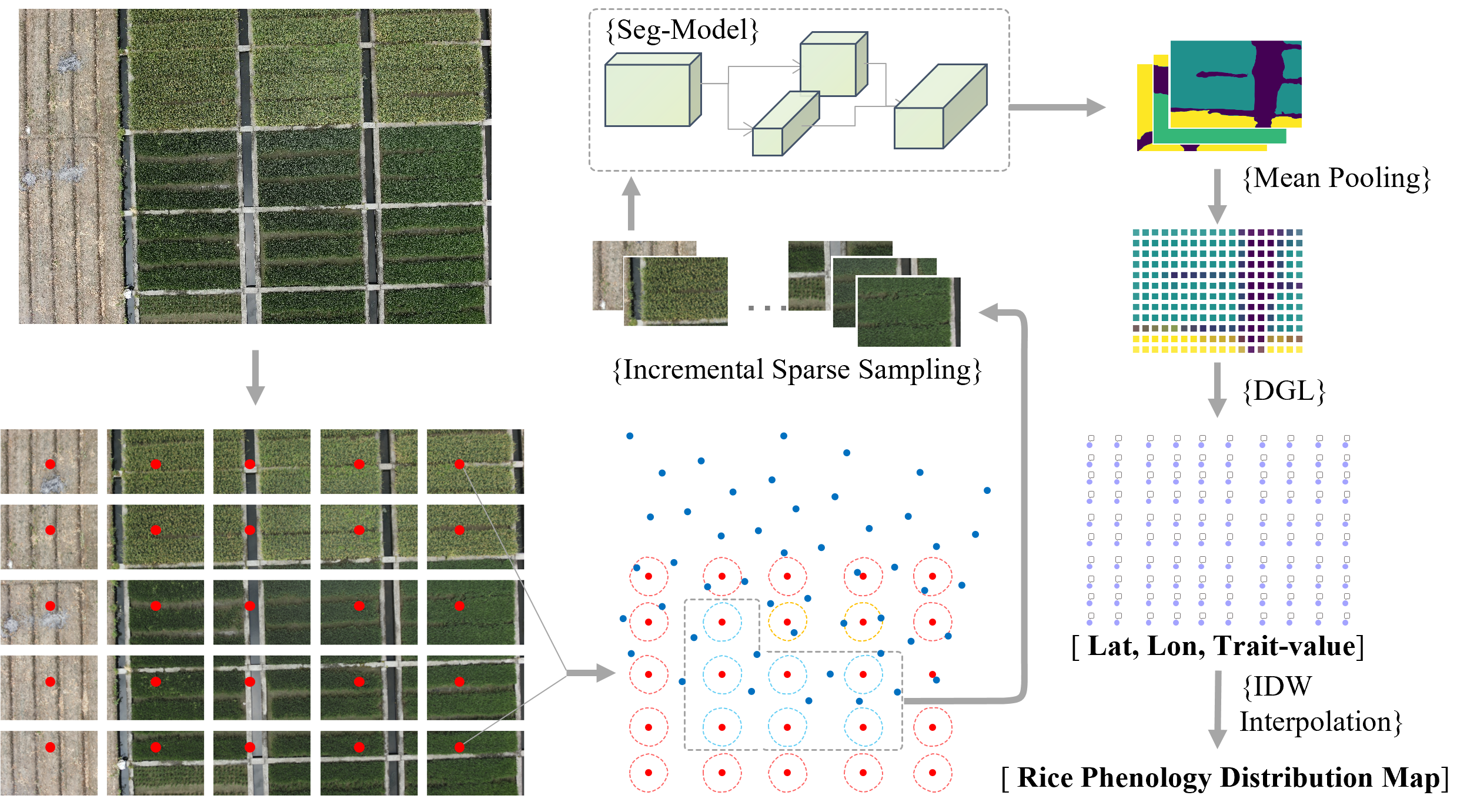
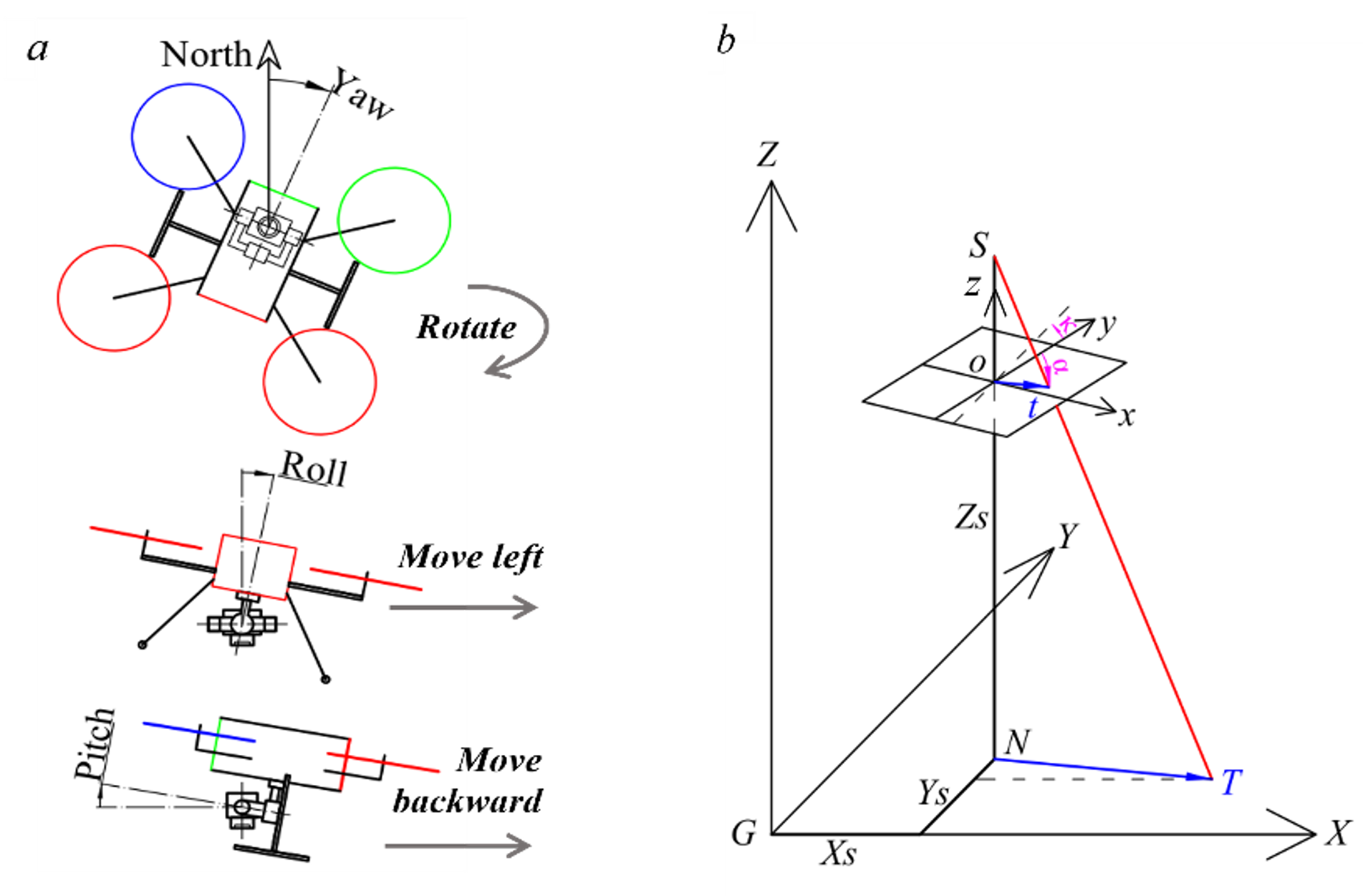
Camera parameters and central projection map image pixels directly to ground coordinates. Incremental sparse sampling removes redundant observations from overlapping UAV images before trait-map interpolation.
The published evaluation reported a mean deviation of 21 cm across 20 ground-control points, below 1% of relative flight height. This provides a direct route from UAV image sequences to georeferenced crop-trait maps.
8. GeT · grape leaf disease and pest diagnosis
Published · JKSU-CIS 2022
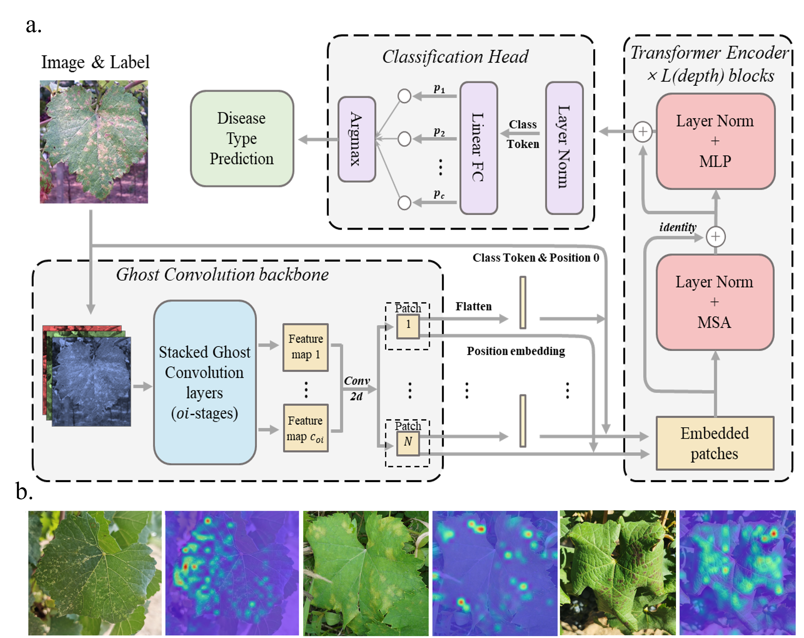
Ghost convolution extracts local symptom features with inexpensive linear operations; transformer self-attention adds global context for grape-leaf disease and pest classification against complex field backgrounds.
On GLDP12k, the ImageNet-initialized GeT model achieved 98.14% classification accuracy with 1.16 million parameters. The compact architecture supports efficient field-image diagnosis.
7. Cascaded 24-channel weighing system
Engineering project · 2020
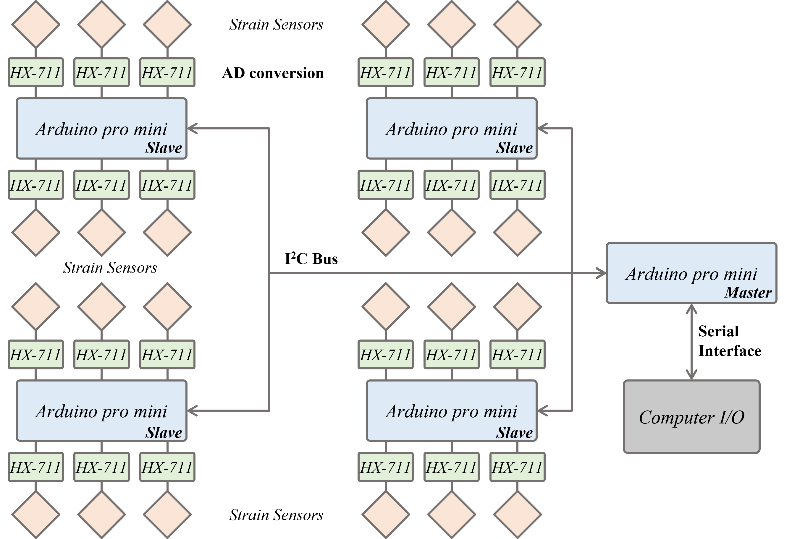
A cascaded I2C architecture links modular weighing nodes to a shared data-acquisition system. Low-power Arduino Pro Mini controllers and plug-in PCBs provide a scalable hardware interface.
The implemented prototype acquires weight measurements across 24 channels, providing a modular basis for parallel weighing experiments.
6. Vision-based citrus sizing
Engineering project · 2020
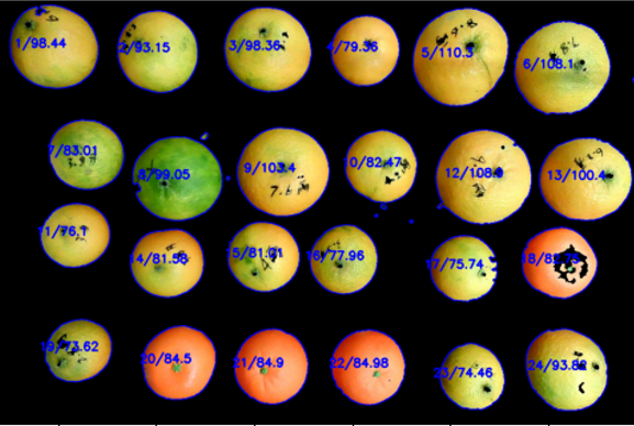
HSV segmentation isolates citrus fruit under controlled-background imaging. Bounding-box pixel dimensions are converted into diameter estimates using the camera imaging geometry.
The workflow provides per-fruit outlines and size estimates for automated measurement; the original calibration plot documents the pixel-to-diameter relationship.
5. LIBS sensing of soil heavy metals
Undergraduate thesis · 2020
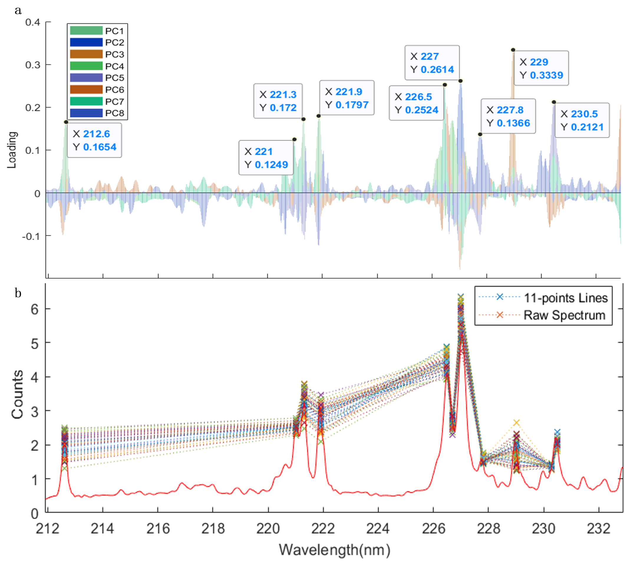
Laser-induced breakdown spectroscopy resolves soil-metal signatures from plasma emission spectra. Argon-assisted excitation and a light-convergence chamber are evaluated for signal enhancement, with spectral analysis identifying informative wavelength features.
The batch-testing platform design combines sample handling and optical acquisition for laboratory soil analysis. The linked slides and device patent document the spectroscopy and signal-collection approach.
4. Integrated seeding and fertilizing device
Engineering contest project · 2019
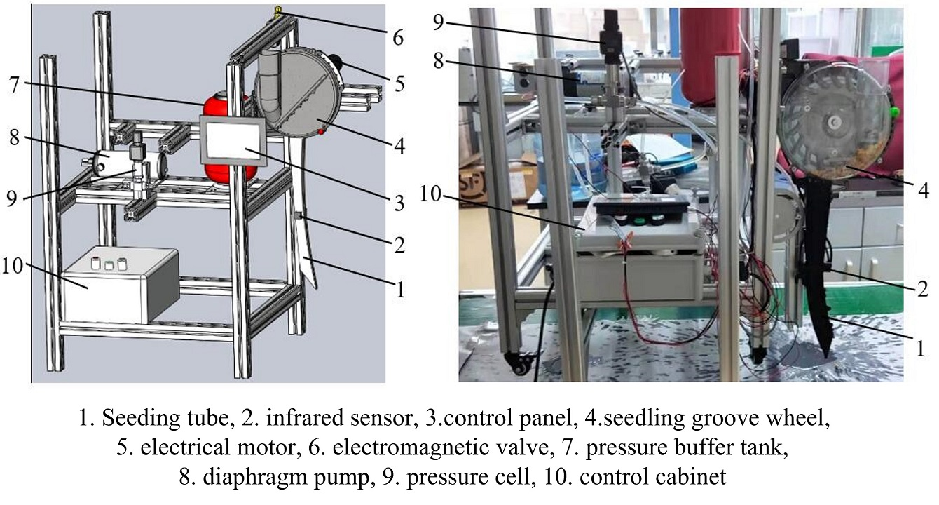
Coordinated motor and valve control combines seed metering with liquid-fertilizer application in one mechanism.
The assembled prototype synchronizes seed delivery and spraying, demonstrating integrated electrical control of two field operations.
3. Reciprocating mechanism using a curved-groove ball bearing
Mechanical design · 2019
A curved-groove bearing mechanism converts rotary input into reciprocating linear motion through constrained rolling contact.
The mechanical design and motion animation demonstrate an alternative rotary-to-linear transmission concept for reciprocating machinery.
2. Weed identification from UAV imagery
Undergraduate research project · 2018
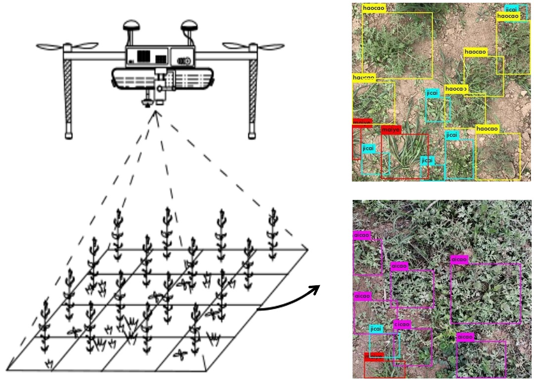
A labeled UAV-image dataset covers five weed types in seedling-stage wheat fields. Real-time convolutional models translate aerial observations into weed-category predictions.
The workflow connects aerial image acquisition, annotation, and recognition for field weed surveys. The poster and related UAV spraying-device patent preserve the original project materials.
1. Electric-vehicle charging-station network planning
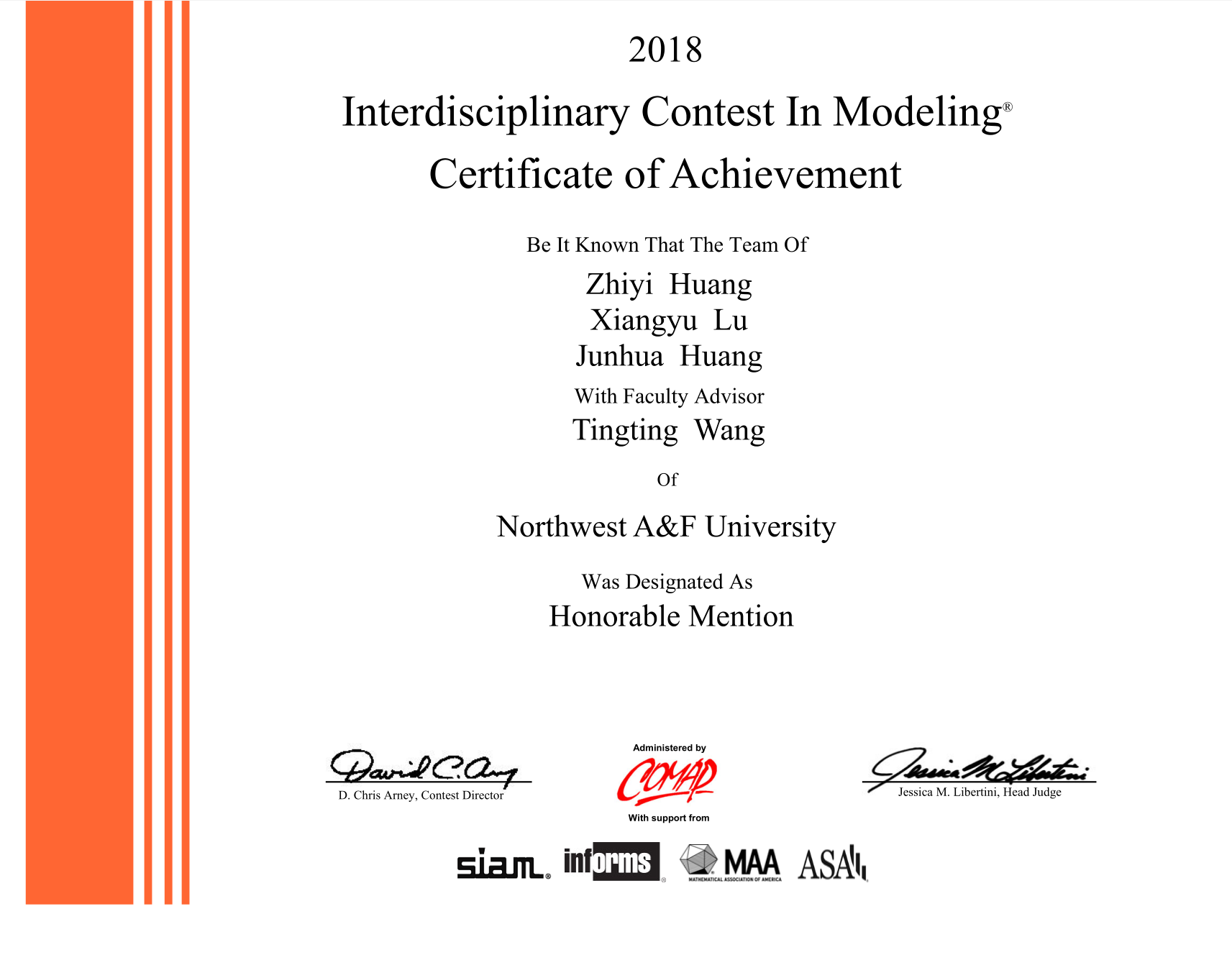
Mathematical modeling project · ICM 2018
Polynomial curve fitting represents electric-vehicle growth, while a multi-objective location model evaluates candidate charging-station configurations.
The MATLAB implementation produces spatial deployment scenarios for demand-oriented charging infrastructure planning.